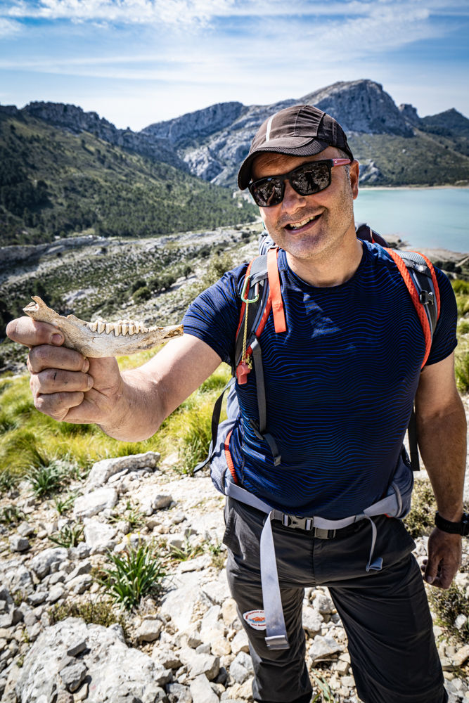
Hike on Mallorca/Majorca - Climbing the Puig des ses Vinyes
- Wibke Helfrich
- Feb 6, 2023
- 3 min read
Updated: Jul 16, 2024

Climbing Puig des ses Vinyes 1,097m - the second highest mountain in Mallorca is not an easy hike nor a Sunday stroll. Here you will find everything you need to know - including GPS Data.
When you read the data on an hiking App, you might think that the hike to ascent the summit of Puig des ses Vinyes 1,097m in Mallorcais easy. But far from it - the peak, which looks like a gentle ridge from afar, has a lot going for it: because as opposed to gentle, the entire approach leads through highly fissured limestone.
Puig des ses Vinyes mallorca hik
Key Facts: Hike Mallorca: Climbing the Puig des ses Vinyes
♡-Factor: ♡♡♡♡♡
Start: Small parking bay on the left side of the MA 10 coming from Soller - After the military area and about 500m before the Cuber reservoir.
Duration: 3 hours
Length: 5,5 km
Altitude: 350 m. up 280 m. down
Difficulty: Hard/black
GPS Data: I have saved the walk in outdooractive for you.
Note: The hike is not marked and very difficult to find. You should do it only, if you are an experienced hiker as it also leads through very challenging terrain. Even our guide Josep had to reorientate himself a few times. The hike leads past military terrain and over private property. In Mallorca, tours are often closed because hikers do not follow the rules (close fences, take rubbish with them, etc.). So please behave accordingly ...
Hiking guide:

The best thing about the hikes with Josep are his rustic snacks! Joking aside: as soon as you leave the island's main hiking trails, orientation can become quite challenging.
On difficult tours, such as crossing Torrent de Pareis or climbing Puig de Migdia, guidance from hiking professionals with local knowledge can be very helpful. Josep Suau, +34 680417900, mallorcawalks.com.
Description:
The climb runs parallel to Puig Mayor which gave us great views the whole way up the peak, which was covered in snow in March. Fun scrambles may not be for someone with a fear of heights,
we feel like we are in an adventure playground and have a lot of fun.
Halfway along the trail, we cross the ridge from left to right and the Cuber reservoir comes into view. Again and again we had to climb and jump over lower ones. The route to the summit is an easy climb. The way back is much easier and simpler: It leads on a track through the small cutting between Puig Mayor and Puig des ses Vinyes ... however, as described above, you should keep a low profile here ...
Click on the first picture to start the photo gallery:
General Infomation:
BEST TIME
The best time for hiking is between mid-February to the end of May. From June to mid-September it is often quite hot. From September to the end of October, the island is not quite as green, but the sea is still warm enough for swimming.
LITERATURE
Mallorca – Die schönsten Küsten- und Bergwanderungen. Rother Hiking Guide revised edition 2021 only available in german.
WEATHER
With 300 days of sunshine a year, the weather in Mallorca is rarely really bad for several days. On rainy days, the Serra de Tramuntana is often a weather divide. This means that when it's bad in the west, the weather can be perfectly acceptable in the east - and vice versa.
MAPS
A good hiking map is the Kompass hiking, cycling and leisure map at a scale of 1:75,000, which is also available locally.
For the Tramuntana hiking region, the three sheets "Mallorca Tramuntana Central", "Mallorca Tramuntana Nord" and "Mallorca Tramuntana Sud" by Editorial Alpina at a scale of 1:25,000 are the best choice.
Ideal for the Soller region is the map "Vall de Sóller" (1:15,000), also published by Alpina. The north is covered by the Alpina map "Mallorca Nord" (1:25,000).
EQUIPMENT
Hiking shoes with a good tread are recommended (otherwise the paved paths can become quite slippery ...), rain and sun protection, and - for cooler days - warm clothing. Long, thin trousers or knee-high socks, because the tours that are not so often undertaken lead through high cutting grass that sneakily scratches your legs.


Comments